Sunday, 31 July 2016
Saturday, 30 July 2016
5/24/2016 - Dodge City, KS Supercell and Tornadoes
Walker's Travels |
|
Posted: 29 Jul 2016 03:06 PM PDT
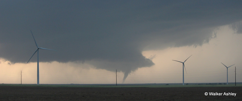
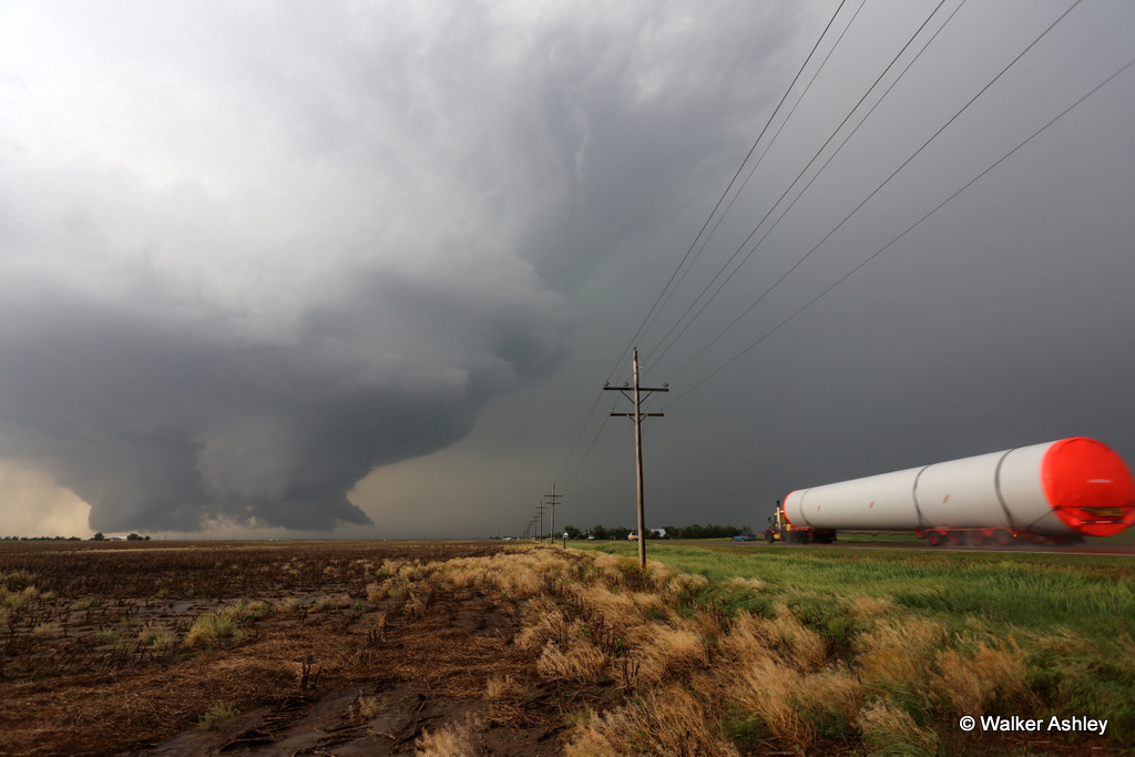
May 24th was just one of those days where that atmosphere decided it was going to throw some nice ingredients together and make a nice, long-lived, slow-moving tornadic supercell. This enhanced day featured a surface low, dryline, and outflow boundary with steep lapse rates, healthy CAPE, and strongly curved hodos. I began the day in Woodward, OK and slid slowly to Buffalo, then Sitka, KS. West of Sitka, I did get a little antsy due to the ongoing tornadic storm well to the north, up near Scott City. Satellite showed nice cu and convergence occurring near Meade, so I kept (impatiently) holding along the US 160-283 corridor. Eventually, as I was sitting north of Minneola, cells began to form to my south. I double-backed and took up shop southwest of Minneola, watching as the storms slowly gathered strength, with three distinct bases consolidating into what would become the storm of the day. The rest is well documented by the hundreds of chasers on the event, so I won't belabor the discussion. I purposely stayed in spots a long time to take in the evolution and structure, trying not to rush after the mesos. When I did take off to the north a couple times, I nearly smacked a deer once, and "enjoyed" a little bit of Kansas mud on another jaunt. At Dodge, I wrapped around town, not wanting to go through populated areas after my El Reno lesson. I witnessed a couple more tornadoes as I drove up to Spearville. I tried to intercept another tornadic storm near Kinsley, but the persistent core ahead didn't permit. Ended the day in Pratt.

Initial tornado sequence northwest of Minneola, KS. See movie below for tornadogenesis.
                 
Second large tornado now southwest of Dodge City, with meso to east producing two squirrelly tubes.


Tornado on west side of Dodge City, with another, eventual tornadic, meso to the east.

Downtown Dodge City to the right...
 
Taken while driving around the southeast Dodge bypass, near the airport entrance. That's a stationary aircraft that's non operational and signifies the airport entrance.

KDDC radar with tornado.

Tornadoes continued to form/track well to the north, but now losing some visibility due to reluctance to take lonely US 283 north due to the hail cores in multiple quadrants.
Last tornado, as seen north of Spearville.

Evening scenes following second, tornadic storm near Kinsley, KS

Time-lapses of dashcam, go-pro clip, and DSLR sequences.

Map of the day's drive ... starting in Woodward and ending in Pratt.
|

Sunday, 10 July 2016
Wednesday, 6 July 2016
Monday, 4 July 2016
Sunday, 3 July 2016
Subscribe to:
Comments (Atom)
Portland Radar. NEXRAD Radar.
Weather On The One, Current National Temperatures
