Cold End To March; Watching Midweek Storm In The Northeast
Weather Outlook
The clipper over the Midwest on Monday will actually play a role in the large storm system that looks to develop off the New England Coast by Tuesday.
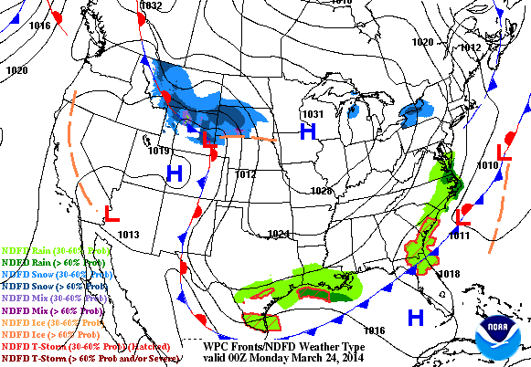
Northeast Storm System
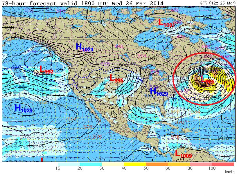
Weather models continue to indicate a very strong wave off the New England Coast by Tuesday/Wednesday. The wind field surrounding this storm looks to be quite impressive, which will likely impact the Northeast.
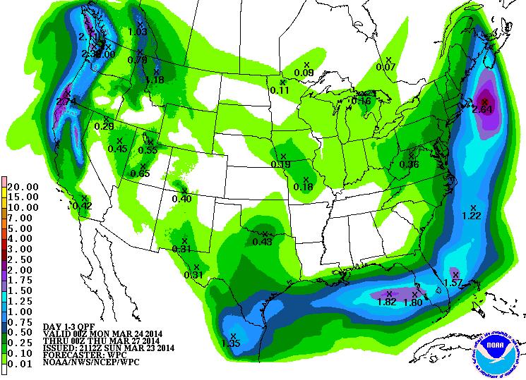
Precipitation Outlook
According to NOAA’s HPC 3 day precipitation outlook, the swath of precipitation that stretches along the Eastern Seaboard will be associated with the developing storm system. It appears that the heaviest precipitation has shifted just a little farther east. However, places right along the coast could see some heavier snow. Stay tuned for more!
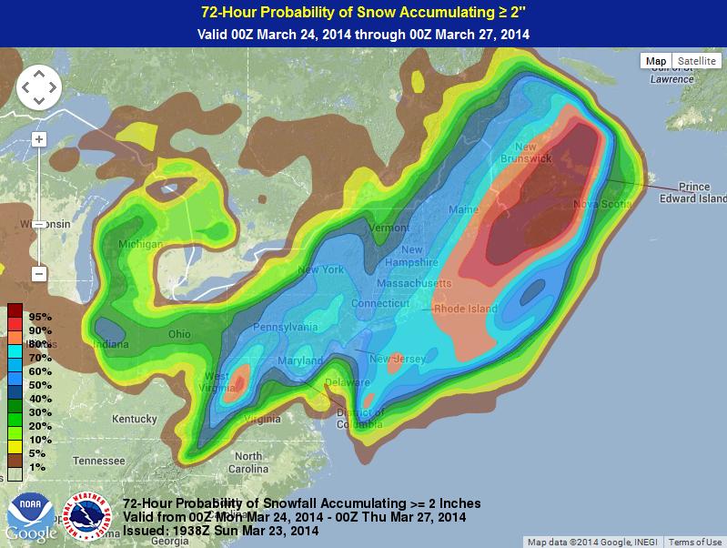
2″ Snow Probability
According to NOAA’s Weather Prediction Center, the probability of at least 2″ of snow through PM Wednesday is the highest right along the coast
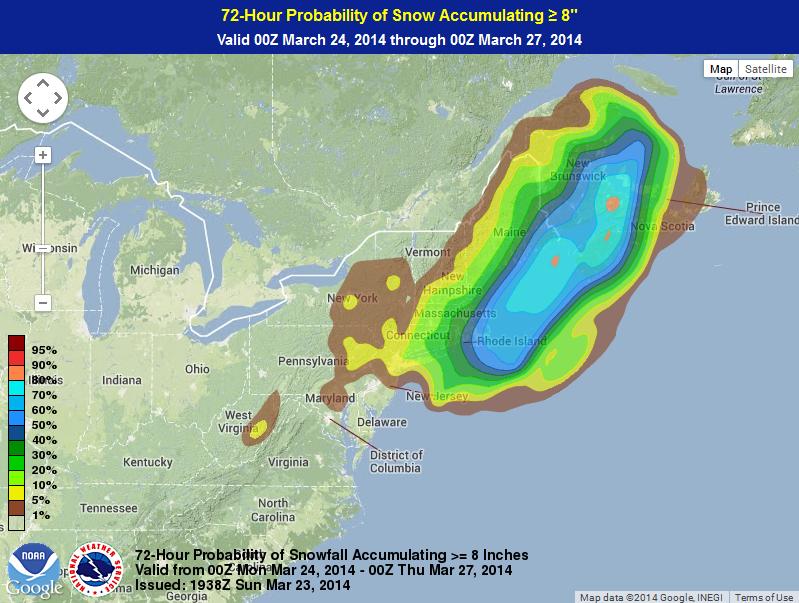
8″ Snow Probability
Here’s NOAA’s WPC probability of at least 8″ of snow or more through PM Wednesday is quite a bit less, but still shows the best potential right along the coast.
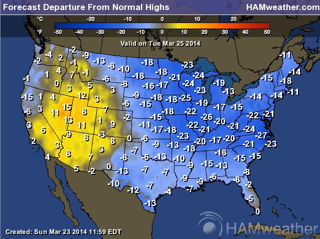
Continued Cold
Unfortunately, the much colder than average weather will continue across the eastern two-thirds of the country through much of the week. Here’s the temperature departure from normal outlook for Tuesday, which shows a significant amount of cold air (for this time of the year) east of the Rockies.
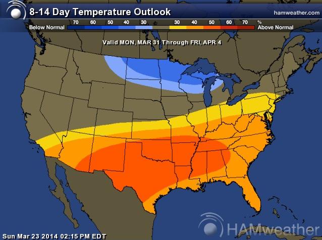
Extended Temperature Outlook
According to NOAA’s CPC, the 8 to 14 day temperature outlook suggests much warmer temperatures moving in across the southern half of the nation, while the Upper Mississippi Valley looks to stay a little cooler than average.
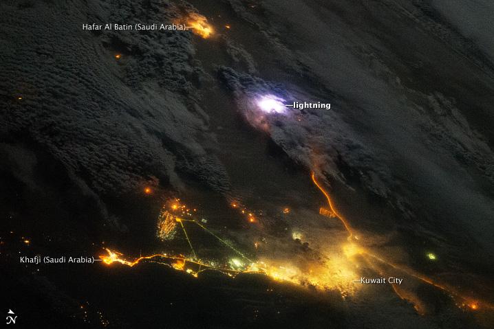
Sensing Lightning from the ISS
Here’s a cool story from NASA’s Earth Observatory, which talks about lightning being observed from space!
“Across the entire atmosphere of Earth, lightning flashes occur about 50 times per second. That’s 4.3 million times a day and 1.6 billion times a year. Using a new instrument on the International Space Station (ISS), scientists hope to capture and dissect at least a few of those flashes every day.
Installed on the ISS in August 2013, the Firestation instrument includes photometers to measure lightning flashes, radio antennas to measure the strength of the lightning, and a gamma-ray electron detector. The instrument was designed to observe about 50 lightning strokes per day and to look for brief bursts of gamma rays that are emitted by some of those strokes. Gamma radiation is usually associated with exploding stars or nuclear fusion, but scientists have found evidence that terrestrial gamma-ray flashes (TGFs) occur in the atmosphere as much as 500 times a day. They are interested in what processes trigger lightning within thunderstorms and what kinds of lightning produce gamma rays. TGFs may also be related to the atmospheric phenomena known as red sprites.”

No comments:
Post a Comment